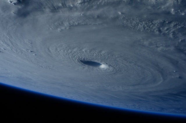
In the span of just 24 hours, Hurricane Erin 2025 accomplished something that left even seasoned meteorologists speechless. This Atlantic powerhouse exploded from a modest tropical storm to a Category 5 hurricane with 160 mph winds, becoming one of the fastest-intensifying storms ever recorded in the Atlantic basin. But Erin’s record-breaking journey isn’t just about impressive statistics – it’s a stark reminder of how our changing climate is supercharging hurricanes in ways we’re only beginning to understand.
The Anatomy of an ‘Explosive’ Storm
Hurricane Erin 2025 first emerged as a tropical wave off the coast of West Africa on August 11, following the typical path many Atlantic hurricanes take. What happened next defied expectations. Between the early morning hours of August 15 and August 16, Erin underwent what meteorologists call “explosive intensification” – gaining 85 mph in wind speed in less than 25 hours.
To put this in perspective, rapid intensification is officially defined as a hurricane gaining 35 mph in wind speeds within 24 hours. Erin nearly tripled that threshold. The storm’s central pressure plummeted from 982 millibars to an incredible 915 millibars – a drop of 67 millibars that rivals some of the most intense pressure drops on record.
Mike Brennan, Director of the National Hurricane Center, called Erin “extremely powerful” and noted how it had “explosively deepened and intensified” overnight. This wasn’t just rapid intensification – this was rapid intensification on steroids.
Breaking Records Before September
What makes Hurricane Erin 2025 particularly remarkable isn’t just its intensity, but its timing. Erin became the earliest Category 5 hurricane ever observed in the open Atlantic Ocean. Historically, the peak of hurricane season – and the time when Category 5 storms typically develop – occurs in September and October, when ocean temperatures reach their annual maximum.
According to National Hurricane Center records, Erin’s 24-hour intensification was the greatest of any Atlantic hurricane before September 1 based on central pressure drop. This early-season intensity is unprecedented and signals a troubling trend in hurricane behavior that climate scientists have been tracking for years.
The storm joins an elite club of only 43 Atlantic hurricanes that have ever reached Category 5 strength on record. But unlike its predecessors, Erin achieved this milestone when ocean temperatures should theoretically be less conducive to such extreme intensification.
The Science Behind Rapid Intensification
Understanding why Hurricane Erin 2025 intensified so dramatically requires examining the perfect storm of conditions that fuel these meteorological monsters. Hurricanes are essentially heat engines that convert warm ocean water into kinetic energy. The warmer the water, the more energy available for the storm to harvest.
For a hurricane to intensify into Category 5 status, it needs sea surface temperatures of at least 26.5°C (about 80°F) extending down to a depth of approximately 50 meters. But it’s not just surface temperatures that matter – it’s the depth of that warm water layer, known as ocean heat content.
Recent analysis shows that climate change has been supercharging this process. A 2024 study found that ocean temperatures made higher by human-caused global warming increased wind speeds for most Atlantic hurricanes by an estimated 19 mph on average between 2019 and 2023. For Hurricane Erin, the abnormally warm Atlantic waters in August 2025 created an environment where rapid intensification became not just possible, but almost inevitable.
The process becomes a self-reinforcing cycle: warmer oceans evaporate more water vapor into the atmosphere, and a warmer atmosphere can hold approximately 7% more moisture for every degree Celsius of warming. This extra moisture doesn’t just mean more rain – it represents stored energy that gets released when the water vapor condenses, further fueling the storm’s intensity.
Learning from Hurricane History’s Speed Demons
Hurricane Erin 2025 now ranks among the fastest-intensifying hurricanes in Atlantic basin history, joining notorious storms like Hurricane Wilma (2005) and Hurricane Felix (2007). Wilma holds the all-time record for rapid intensification, with a 24-hour pressure drop of 97 millibars as it exploded from a Category 1 to Category 5 hurricane. Wilma’s central pressure reached an astounding 882 millibars – the lowest ever recorded in the Atlantic.
Hurricane Felix in 2007 demonstrated similar explosive behavior, rapidly intensifying from a tropical depression to Category 5 status in just 48 hours. Like Erin, Felix caught forecasters off guard with its unprecedented speed of intensification, ultimately making landfall in Central America as one of the most powerful hurricanes ever to strike the region.
What links these storms isn’t just their intensity, but their timing and the oceanic conditions that fueled them. All occurred during periods of unusually warm sea surface temperatures, and all demonstrated the increasing tendency of modern hurricanes to undergo rapid intensification cycles that can catch both forecasters and coastal communities unprepared.
The Climate Change Connection
The frequency of rapidly intensifying hurricanes like Erin isn’t coincidental – it’s symptomatic of our changing climate. Data from Climate Central reveals a stark trend: between 2004 and 2023, 93 Atlantic hurricanes underwent rapid intensification (gaining 35+ mph in 24 hours), compared to just 69 hurricanes in the previous 20 years from 1984 to 2003.
Even more concerning is the rise in “extreme rapid intensification” events – storms gaining 58+ mph in 24 hours. This phenomenon occurred 27 times in the 20 years from 2004 to 2023, compared to only 12 times in the previous 20-year period.
The culprit is clear: human-caused climate change is loading the dice in favor of more intense hurricanes. Ocean temperatures in the Atlantic have been breaking heat records, with some areas experiencing temperatures that would be “virtually impossible without the influence of carbon pollution,” according to Climate Central research.
Research published in Environmental Research: Climate found that 30 out of 38 Atlantic hurricanes between 2019 and 2023 reached intensities roughly one category higher on the Saffir-Simpson Hurricane Wind Scale compared to their expected strength without climate change. Hurricane Erin appears to follow this troubling pattern.
What This Means for Future Hurricane Seasons
Hurricane Erin 2025’s record-breaking intensification offers a preview of what we can expect from future hurricane seasons in a warming world. As ocean temperatures continue to rise and atmospheric moisture content increases, the conditions that created Erin’s explosive growth are becoming more common, not less.
The implications extend far beyond meteorological records. Rapidly intensifying hurricanes are among the most dangerous because they give coastal communities less time to prepare and evacuate. When Hurricane Michael rapidly intensified to Category 5 status just before making landfall in Florida in 2018, it caught many residents off guard, contributing to significant casualties and damage.
According to research from the Environmental Defense Fund, hurricanes are also moving more slowly as they approach land, a phenomenon linked to changing wind patterns in a warming climate. This combination of rapid intensification and slow movement creates a worst-case scenario: more powerful storms that linger longer over populated areas.
Preparing for a New Reality
The era of Hurricane Erin-style rapid intensification demands a fundamental shift in how we approach hurricane preparedness and forecasting. Traditional models that relied on gradual storm development over several days are being challenged by storms that can explode in intensity within hours.
For coastal residents, this means hurricane preparedness can no longer wait for specific storm threats. Emergency kits, evacuation plans, and property protection measures need to be in place well before hurricane season begins. The luxury of waiting to see how a storm develops is disappearing as rapidly as Hurricane Erin’s pressure dropped.
From a broader societal perspective, Hurricane Erin 2025 underscores the urgent need for climate action. While we cannot prevent hurricanes, we can still influence their future intensity by addressing the root cause: greenhouse gas emissions that are warming our oceans and supercharging these storms.
The National Hurricane Center and other forecasting agencies are also adapting, investing in improved satellite technology and computer models that can better predict rapid intensification events. However, as NOAA research indicates, even the most sophisticated models struggle to predict the precise timing and magnitude of explosive intensification like what Hurricane Erin demonstrated.
The Bottom Line
Hurricane Erin 2025 didn’t just break records – it shattered our expectations about how quickly Atlantic hurricanes can intensify. Its transformation from tropical storm to Category 5 hurricane in less than 25 hours represents a new benchmark for rapid intensification and a stark warning about the future of hurricane activity in a warming world.
As we continue to pump greenhouse gases into the atmosphere and warm our oceans, storms like Hurricane Erin will become less exceptional and more routine. The question isn’t whether we’ll see more record-breaking rapidly intensifying hurricanes, but how well we’ll adapt to a reality where Category 5 storms can emerge with little warning from seemingly modest tropical systems.
The science is clear, the trends are undeniable, and Hurricane Erin 2025 has provided the latest – and perhaps most dramatic – evidence yet that our relationship with hurricanes is fundamentally changing. How we respond to that reality may determine how well coastal communities weather the storms to come.